| Part 1 | SCD Website |
I thoroughly enjoyed first half of the route, finishing it, and having a chat about the experience with others over a pint sounded quite enticing to me. Working in 271km (>6000m of ascent) around a full time job meant it would be a long and tough weekend expedition.
Friday 2nd - Back to the line
I’ve religiously stook to the line during initial attempt, so it was only right that I’d pick up exactly where I left off (unfortunately, Stuart couldn’t make it for this mad dash). To maximize my chances to reach the finish line and get back home in time, I booked a single night stay in the YHA Alston, which meant I could resume the route first thing Saturday morning.
First thing after work on Friday, I jumped on a train to Penrith (luckily no cancellations this time) [1]. From there I followed C2C route over Hartside pass back into North Pennines AONB. Hostel is very accommodating of cyclists, clean and comfortable with friendly owners, would recommend it as a stop. After check-in I grabbed a hot pizza and some snacks for Saturday from near by shop/gas station.
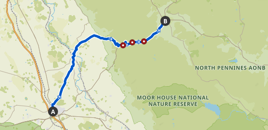 | ~36km, ~840m asc, 1h50min moving time, Strava Activity, Komoot Tour |
Saturday 3rd - The big’un
Poor night’s sleep in anticipation of the day ahead made for an easy, pre-dawn wake up call. After a filling breakfast in a dark, hostel kitchenette, I was out on road - 5:38am.
 | 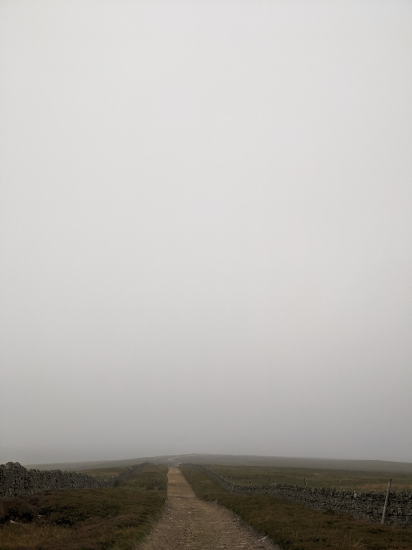 |
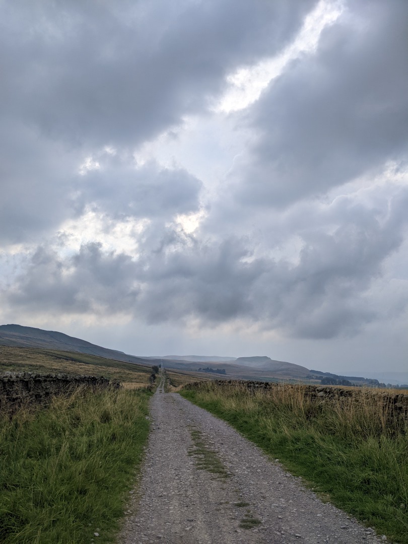
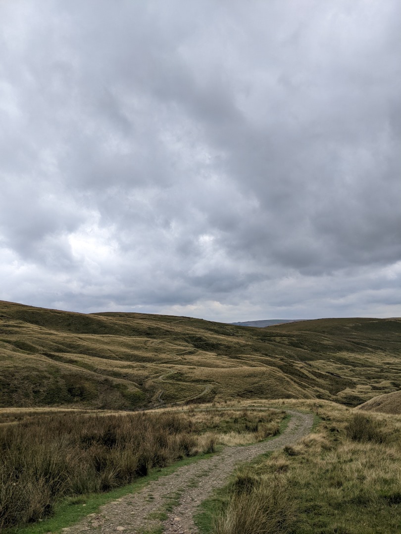
Heading up Cross Fell was nice and gentle at first, but as elevation rose, visibility declined (cloud sitting atop the moor might have something to do with it). Trail at times descended into a rock fall - not great for either riding nor hike-a-bike. This proved notably more difficult than anticipated, taking several hours to reach the peak (pictured below). Descent wasn’t much easier either. Winding grassy path down a steep hillside was quite treacherous in the wet (luckily visibility was improving due to strong winds). Swampy/marshy ponds scattered along the trail downhill bathed me and my bike in mud, despite my best attempts at staying presentable.
Tracing the bottom of the hills was nice, even with headwind, things were quite smooth for a little while.
That’s when I rolled into an Ministry of Defense firing range, red flags flying high didn’t deter me, after all, I had a gpx to trust! Semi-automatic guns and rocket launcher (???) echoed in the distance as dark, but clear thoughts ran through my mind. Sounds only got louder. Catching a glimpse of couple cars gave me hope (for a change). Crested a little hill, I encountered a small battalion blocking the road. Luckily they let me through without a bullet through a tire. One of the soldiers even encouraged me as I rode past.
From there on I slowly, but surely bonked on the way to Tan Hill Inn (highest pub in England), I managed to persevere and get up the main ascent, but any incline thereafter, would force me to walk. Like a desert oasis, roof of the inn appeared in the distance. Unluckily for me, oasis didn’t serve food for another hour. While rest was in order, it did feel like a waste of an hour.
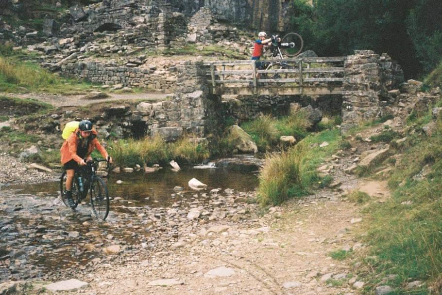
General pub grub later, along River Swale I met Clare and Ed who were also riding SCD! (see below, me crossing ford near River Swale, Clare on the bridge, Ed - photographer). We shortly parted ways as I had just recovered and they were about to stop for a break. [2]
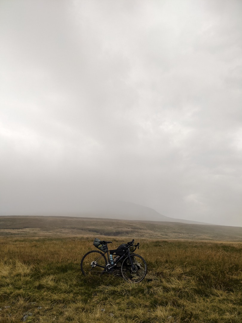
Skip to Cam high road, a very long and barely ridable (at least with my 37mm tyres & no suspension) gravel track, high above anything in the surrounding vicinity. Here, rough and wet ~100km and thousands of meters of climbing later, I started feeling weary. Usual weariness was a given, but being halfway through the day without end anywhere in sight wasn’t motivating. A top all this, I forgot to pack my padded gloves which I usually take with me on gravel/all-road trips to reduce hand and wrist fatigue. A lesson vibrated into my being for next adventure.
Somewhere high in the hills, the road turns becomes paved, it felt truly blissful having order of magnitude fewer vibrations through my sore hands. Before enjoying the descent, some layering up was needed as rain clouds were rolling in from all directions. Ribblehead Viaduct is a fantastic piece of engineering, but what my eyes were firmly set on, was The Station Inn menu. Unluckily, again - all the tables were reserved. Ingleton Co-op ended up being my dinner spot few miles up the road. Whilst browsing/raiding the fridge I clocked couple people near my bike outside the shop, who later turned out to be Clare & Ed! While we parted ways in the town as I initially decided to call it a night early due to fatigue, seeing them carry on into the dark made me overcome the initial slump and chase them. We ended up riding up to Forest of Bowland AONB together, where I finally called it a night.
I watched Clare & Ed ride into the night, as I hurriedly pitched my tent on lower slopes of the moor.
 | ~154km, ~3689m asc, 12h moving time, Strava Activity, Komoot Tour |
Sunday 4th
Windy, damp night was followed by a windy, damp morning. Having borderline passed out in my sleeping bag definitely helped to deal with rock filled surface under the tent. Aiming to catch-up to and overtake Clare and Ed, I set off at 5:41am. Long story short, I didn’t catch them.
First target for the day was nearest McDonald’s en-route, in Colne, 50km from my pitch. Getting there felt like one of the longest, most arduous challenges I’ve ever faced. The rhythm of constant riding & fueling and picking the next ‘checkpoint’ had firmly set in. Same can be said about constant tiredness. Having managed to catch breakfast menu felt like a Herculean victory I needed.
Stripping off mud & sweat covered waterproofs in McDonald’s car park, to eat greasy food, felt grim, but also freeing. Not an experience I wish to force upon myself or anyone, but in right mindset, conditions & circumstances, definitely good fun. At this point there was ~74km to the finish line, and with significant amount of climbing left, I rushed away.
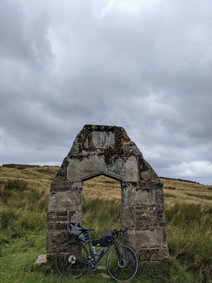 |  |
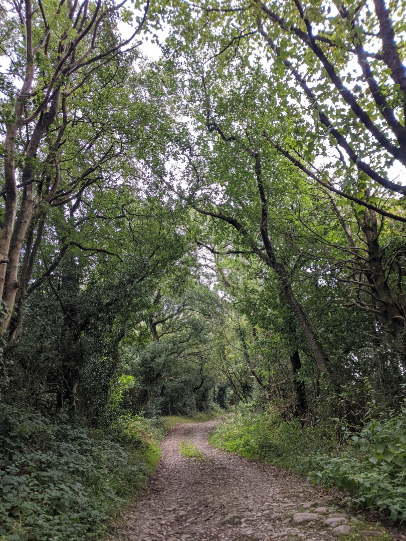
Next several hours are mostly a blur in my memory. The lanes were beautiful and enjoyable, definitely worth a visit. Somewhere along the Lancashire gravel I saw an old ruin, an unpaved Stelvio rip-off and draught struck reservoir. It’s one thing to hear about the damage summer heatwave had caused, but another to see it first hand.
While only vague memories remain, whole section between Bacup to final summit, was excruciating. Fatigue had reached new lows and every hike-a-bike, felt like a personal insult. But being so close to finish, and so far from alternatives meant I had no other choice but to follow gpx.
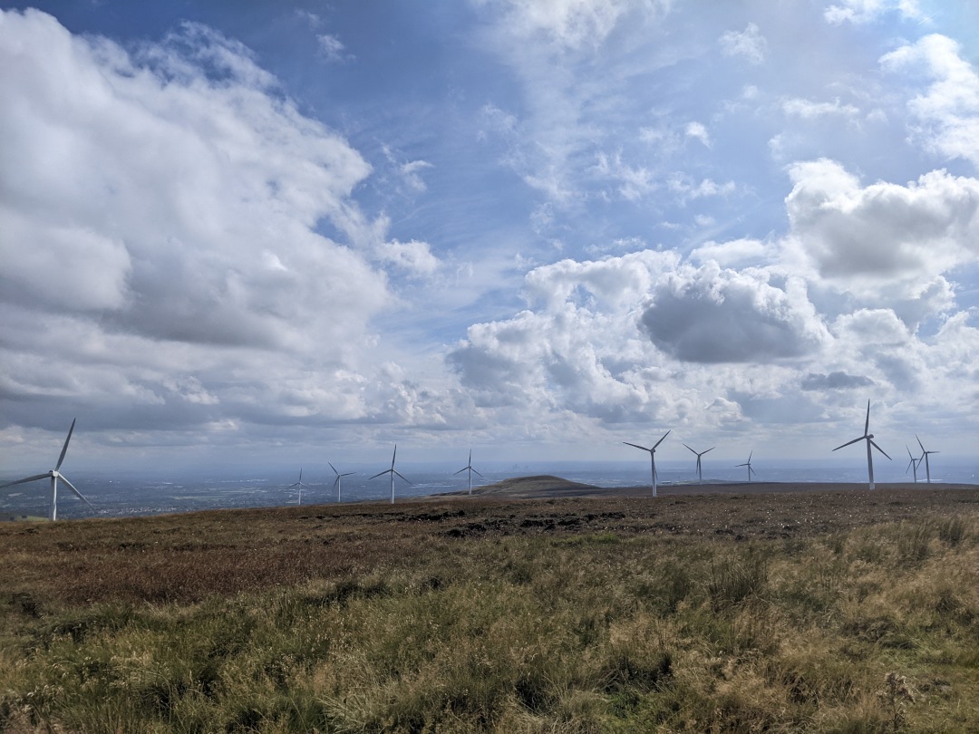
High above Bury, I caught first glimpses of Manchester skyline. Finishing the ride via a windfarm after starting by riding through one, felt like a very fitting ending (not sure if by design or coincidence). As thrilled as I was to ride downhill straight to a cold pint, things weren’t going to get easier. Every bump along the road, every effort to keep out busy roads chipped away at me. But as soon as I hit the National Cycle Network Route 6, all my worries went away and I felt at ease again!
Rolling into Manchester wasn’t as difficult as I had initially feared, but finding the mass mini finish location proved to be troublesome, but very much worth it.
 | ~117km, ~2440m asc, 9h54min moving time, Strava Activity, Komoot Tour |
Reflections
- SCD FAQ “3 to 6 days - don’t underestimate it” recommendation holds up. This isn’t a route to take lightly, and is definitely best enjoyed at leisurely pace in good company.
- Midge repellent spray & a head net are definitely worth packing
- Bring reliable waterproofs
- Having a map/list of public bathrooms/inns/restaurants is a worthwhile investment
- Northern 2/3rds of the route are some of the most remote I have experienced within UK, be self-sufficient
- Don’t feed the Glasman